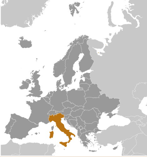
Map of Italy
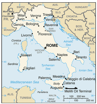
Area of country: total: 301,340 sq km
country comparison to the world: 72land: 294,140 sq km
water: 7,200 sq km
note: includes Sardinia and Sicily
Land boundaries
Coastline/km: 7,600 km
Climate: predominantly Mediterranean; Alpine in far north; hot, dry in south
Terrain: mostly rugged and mountainous; some plains, coastal lowlands
Elevation extremes: lowest point: Mediterranean Sea 0 mhighest point: Mont Blanc (Monte Bianco) de Courmayeur 4,748 m (a secondary peak of Mont Blanc)
Natural resources: coal, mercury, zinc, potash, marble, barite, asbestos, pumice, fluorspar, feldspar, pyrite (sulfur), natural gas and crude oil reserves, fish, arable land
Land use:
arable land: 26.41%
permanent crops: 9.09%
other: 64.5% (2005)
Natural hazards: regional risks include landslides, mudflows, avalanches, earthquakes, volcanic eruptions, flooding; land subsidence in Venicevolcanism: significant volcanic activity; Etna (elev. 3,330 m), which is in eruption as of 2010, is Europe's most active volcano; flank eruptions pose a threat to nearby Sicilian villages; Etna, along with the famous Vesuvius, which remains a threat to the millions of nearby residents in the Bay of Naples area, have both been deemed "Decade Volcanoes" by the International Association of Volcanology and Chemistry of the Earth's Interior, worthy of study due to their explosive history and close proximity to human populations; Stromboli, on its namesake island, has also been continuously active with moderate volcanic activity; other historically active volcanoes include Campi Flegrei, Ischia, Larderello, Pantelleria, Vulcano, and Vulsini
Environment-current issues: air pollution from industrial emissions such as sulfur dioxide; coastal and inland rivers polluted from industrial and agricultural effluents; acid rain damaging lakes; inadequate industrial waste treatment and disposal facilities
Geography-Note:
strategic location dominating central Mediterranean as well as southern sea and air approaches to Western Europe
Map of Italy's Region
Mayor River Italy
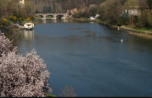
1) Po River
Po is one of the largest rivers in Italy and it flows through some of the most vital cities across Italy such as Turin, Ferrara and Piacenza. This river measures 405 miles in length and 1,650 feet at its width and is definitely small when compared to the Nile river or the Yangtze. Around 141 tributaries feed this vast river along with a catchment basin of around 27,000 sq miles that leads to the plains of Val Padana.
Po is one of the largest rivers in Italy and it flows through some of the most vital cities across Italy such as Turin, Ferrara and Piacenza. This river measures 405 miles in length and 1,650 feet at its width and is definitely small when compared to the Nile river or the Yangtze. Around 141 tributaries feed this vast river along with a catchment basin of around 27,000 sq miles that leads to the plains of Val Padana.
Mountain Ranges Italy
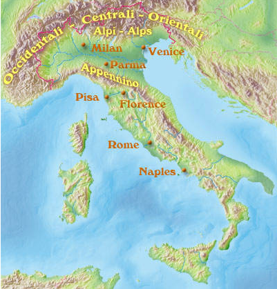
Mountain Ranges: There are two major mountain ranges in Italy, the Alps and the Appenninoor Apennines. The Alps, divided into regions called, from west to east the Occidentali, the Centrali, and the Orientali, border with France, Austria and Switzerland. The backbone of Italy is formed by the north-south trending Appennino chain. You may hear of the Dolomites, which are really part of the Alps, located in the regions of South Tyrol, Trentino and Belluno The highest point in Italy is Mont Blanc, in the alps at 15,770 feet
